
Landsat Works
© Richard John SeymourLandsat 8 launched on 11 February 2013. Since then it has supplied a constant stream of imagery of our planet into the public domain.
Landsat captures 9 different wavelengths of the light spectrum, known as bands, ranging from UV to Infrared. Though we are most accustomed to seeing the information Landsat captures in the visible spectrum (which represents what our eyes see), the non-visible information captured by Landsat can be utilized for various scientific and industrial applications.
One such use of this type of imagery is in mineral prospecting. By assigning certain bands to the RGB channels used in digital images, a false-colour image can be generated that can indicate the presence of certain geological conditions by rendering them in easily detectable colours that would be otherwise invisible to the human eye. Through this process even the world’s most remote wildernesses can be observed and analysed on a daily basis.
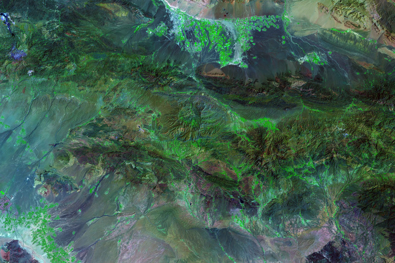
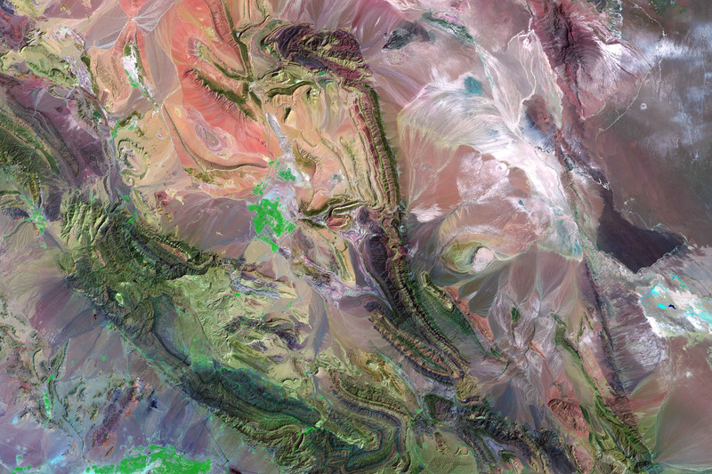
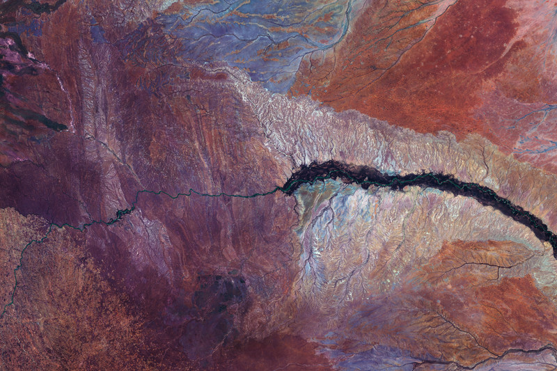
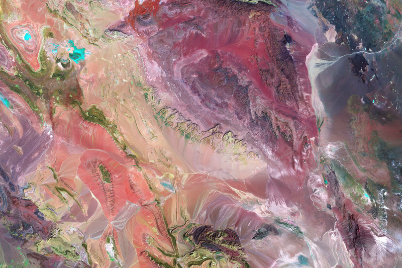
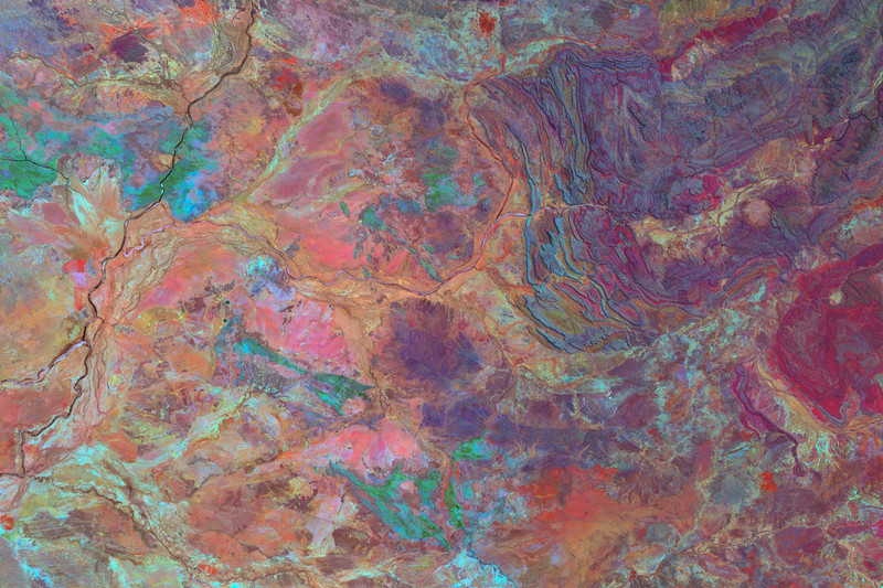
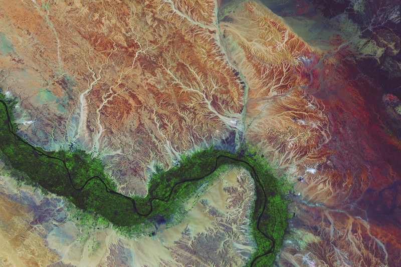
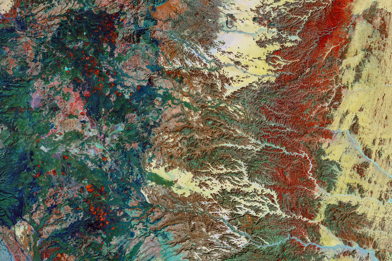
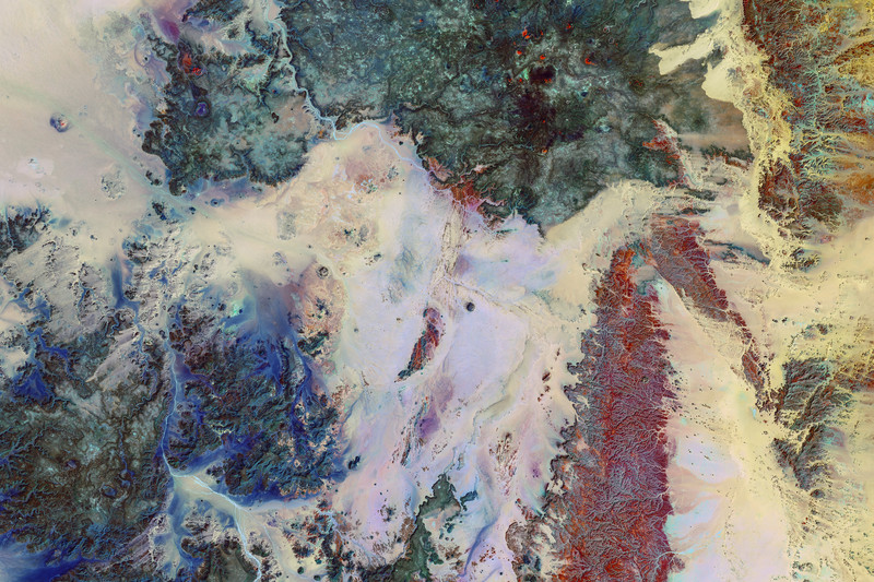
Landsat Works co-opts these false-colour imaging techniques to reveal a number of remote locations across our planet, rendered in brightly coloured hues through the use of digital sensor technology aboard Landsat.
The resulting large format images are at once a statement regarding the role technology plays in the surveillance and subsequent manipulation manipulation of our environment, but also an attempt to reveal the sublime through the technological gaze.
click to view the complete set of images in the archive
InstituteTM (collectively Institute Pictures, Institute Studios, & Institute Artist) is redefining how stories are produced and told in the 21st Century. Founded by Producer Frank Evers and Director/Visual Artist Lauren Greenfield, we are a multiplatform production company representing auteur-driven storytellers across commercials, photography, fine art, film, and technology — and producing original work across every screen that those stories live on. Our multiplatform expertise and established global relationships in entertainment, commercial, fine art, and journalism create unmatched reach and cross-pollination of creative work. A film commission informs a photography campaign; a fine art practice shapes a commercial; an editorial relationship opens a documentary. Few companies operate fluently across all of these worlds. Institute was built this way from the ground up.
Clients include: Apple, Google, Meta, Amazon, Microsoft/Xbox, LinkedIn, WhatsApp, Nike, Adidas, Lululemon, Under Armour, Dove, Maybelline, Clinique, Ulta Beauty, Aesop, Vaseline, LEGO, Balenciaga, Dior, Tom Ford, Kenzo, Supreme, Van Cleef & Arpels, Mercedes-Benz, Volvo, Toyota, McLaren, Pennzoil, American Express, Chase, U.S. Bank, Burger King, Chobani, Corona, Pepsi, Nespresso, Lavazza, Velveeta, Airbnb, Four Seasons, Marriott, Instacart, eBay, JCPenney, Levi's, Swatch, Bang & Olufsen, Bayer, Pfizer, Genentech, EA, Planned Parenthood, Ad Council, and the United Nations. Editorial and publishing partners include: The New York Times Magazine, The New Yorker, GQ, Esquire, TIME, Bloomberg, National Geographic, The Economist, Monocle, Le Monde, Stern, Sunday Times Magazine, Phaidon, Steidl, Abrams, Prestel, Chronicle, and Random House.
“Institute” is a registered trademark in the US, Europe, and United Kingdom. All rights reserved.